Genealogists loooooooove maps
Oh yes we do.
Old maps.
New maps.
Road maps.
Tax maps.
The Legal Genealogist and every other family history researcher worth the name — we all loooooooove maps.
Which means we loooooooove David Rumsey and the David Rumsey Historical Map Collection.
Rumsey — his bio on the site tells us — “began building a collection of North and South American historical maps and related cartographic materials in 1980. Eventually the collection expanded to include historical maps of the entire world, from the 16th to the 21st centuries. His collection, with more than 150,000 maps, is one of the largest private map collections in the United States. In 1995, Rumsey began the task of making his collection public by building the online David Rumsey Historical Map Collection, www.davidrumsey.com. Currently the online web site has over 89,000 high resolution images of maps and related images from his collection. The site is free to the public and is updated monthly.”1
This absolutely astounding collection of maps — free to the public — is available to us under a Creative Commons BY-NC-SA 3.0 license: we can “copy and redistribute the material in any medium or format” and “remix, transform, and build upon the material” as long as we (1) give credit, link to the license and mention any changes we made, (2) use the items for non-commercial purposes and (3) allow anyone else to use our work based on the materials on the same terms.2
Yowza.
There’s so much good stuff at the David Rumsey Historical Map Collection that I’m not even going to try to tell you what you might find there. Go. Go now. But make sure you have some time free in your schedule, because you’re going to be there awhile.
And this week… David Rumsey gave us some really cool new types of maps to play with.
Really cool.
Interactive globes.
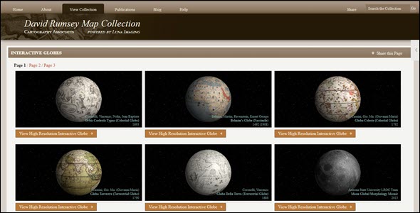
Wanna know what the mapmakers thought the world looked like in, oh, 1492? Check out this interactive globe, based on the maps of Martin Behaim.
Or what the mapmakers of the early 19th century thought the world looked like with all the new discoveries until then? Check out this interactive globe, based on the maps of Aaron Arrowsmith.
Wanna see what the ocean floor around the world looks like? Check out this interactive globe, based on the 1976 maps of the U.S. Office of Naval Research and Lamonat Doherty Geological Observatory.
You can even see what we know, here in the 21st century, about what Jupiter’s moon Io looks like. Check out this interactive globe, based on the work of the USGS Astrogeology Science Center.
There are 18 interactive globes right now that you can access, for free, online at David Rumsey’s site.
Now just how cool is this?
Happy holidays… with a little extra joy from David Rumsey.
Cite/link to this post: Judy G. Russell, “The joy of David Rumsey,” The Legal Genealogist (https://www.legalgenealogist.com/blog : posted 23 Dec 2020).
SOURCES
- “About David Rumsey,” DavidRumsey.com (https://www.davidrumsey.com/ : accessed 23 Dec 2020). ↩
- See “Attribution-NonCommercial-ShareAlike 3.0 Unported (CC BY-NC-SA 3.0),” CreativeCommons (https://creativecommons.org/ : accessed 23 Dec 2020). ↩


YES! David Rumsey’s team has been doing a fantastic job of digitizing and making accessible a wide variety of maps, with the ability to zoom in without loosing resolution. What a wonderful gift to researchers, and map collectors worldwide.
Another great resource, of course, is the Library of Congress map collection where you can download images in high-resolution, such as JPEG2000 that provides great clarity, especially if looking at county maps with names of the land owners. https://www.loc.gov/maps/ .
Yep, I’ve featured the Library of Congress collections (of maps and so much more) in many many posts.
Thank you for the information on the David Rumsey Collection. Two comments that may be of interest to your readers.
They should understand that while the images on the Rumsey site are mostly eligible for non-commercial use, the site also states that “Be aware that maps and images originally published after 1924 may still be under copyright, and it is your responsibility to check copyright status on such images before using them.” https://www.davidrumsey.com/about/copyright-and-permissions
I am creating a book on my colonial ancestors and it is difficult to find relevant maps to include. I consider the book as “non commercial” since I will make it available in pdf format free of charge. But, in order to reach more potential readers, I may ultimately need to distribute the e-book on an online site (e.g. Amazon), which will force me to charge a retail price of at least 99 cents. I hesitate to create the book with images under the “Creative Commons BY-NC-SA 3.0 license,” in the event that I later determine there is a need to sell the book at 99 cents per copy. I would not consider this as violating the disqualifying criteria of “primarily intended for … monetary compensation”… not going to get rich on that revenue — but I don’t want to end up in a court of law about the matter.
For anything published in the United States after 1925 (as of 1/1/2021) or more recently in some foreign countries where the copyright term is shorter, it will be necessary to consider the copyright status of the work, and getting permission from any copyright holder is the way to go.
@Alan Wilcox,
If the original of a map you wish to use is out of copyright or perhaps was never subject to copyright in the USA because of a failure to comply with the formalities (registration, copyright notice etc) when it was published, then you should be able to go ahead and use the map in your (perhaps commercial) book. The fact that Mr Rumsey has kindly digitized the map does not automatically mean that his version has revived or somehow created a new copyright. Digitization alone is not the sort of creativity (“fruits of intellectual labor” ) which garners a new copyright. (Authority: US US Copyright Office Compendium Edition 3 paras 306 and 308).
To qualify as a derivative work, and thus be eligible for new copyright, the digitized work would need to exhibit some clear human creativity on its face. Almost by definition, Mr Rumsey’s efforts are intended to provide old maps in their original form without editorial amendments. As such they would not be copyrightable (see the famous court decision known as Bridgeman Art Library vs Corel Corp. 1999). Even if there was some additional originality independently added by Mr Rumsey (eg the interactive element in some maps/globes) copyright protection would only extend to those new elements, and the underlying map would remain free of copyright.
The issue is not copyright when you retrieve an out-of-copyright work from a website; it’s contract — what do the terms of service allow? Terms of service are why out-of-copyright newspapers are freely available and reproducible if downloaded from, say, the Library of Congress’ Chronicling America site — but can’t even be transcribed for other than the most personal use at GenealogyBank.
David Rumsey’s site is one of my faves for maps, along with the National Library of Scotland, McMaster University Library, and Vision of Britain…At Rumsey’s site last week, I found some wonderful maps of Tasmania, while researching a collateral who’d been transported there in 1823.